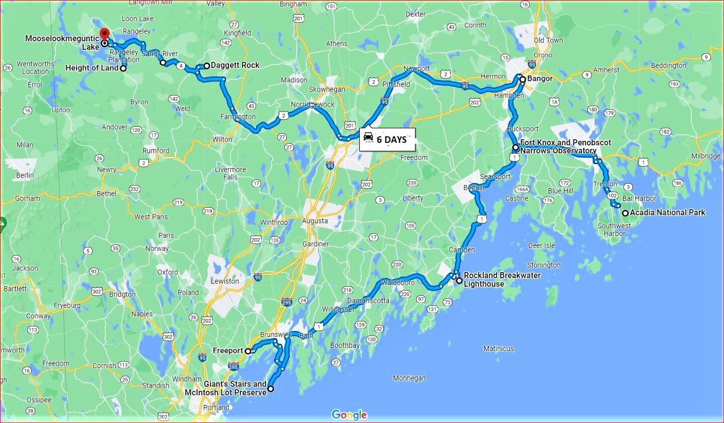
Our 3-week driving trip through New England started from Freeport, Maine where we drove into from Boston. We took the coastal route towards Acadia National Park and then moved west towards the Rangeley Lake region.
Maine is the biggest state in New England and driving distances are large. Often, it takes longer than expected because of traffic and speed restrictions. We were there in September – a bit early for the lovely autumn colors.
Here’s a map of our driving route and the highlights of what we saw in the 6 days in Maine.
DAY ONE
Giant’s Stairs Trail and McIntosh Lot Preserve
About an hour’s drive from Freeport is this gem with dramatic coastal scenery.
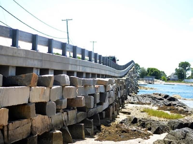
The route 24 crosses the unusual Cribstone Bridge to reach Bailey Island in Harpwell. This narrow bridge, built in 1927, is made of large granite blocks stacked on each other. It is listed as a historic civil engineering feat.
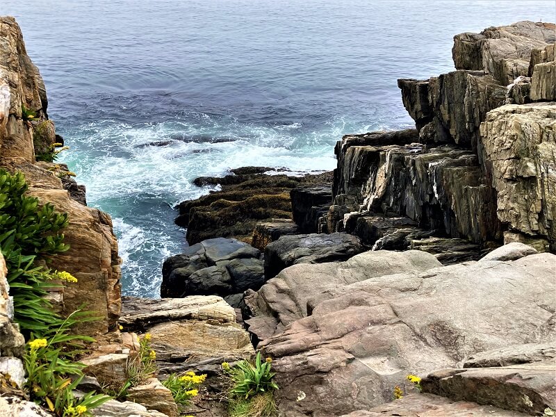
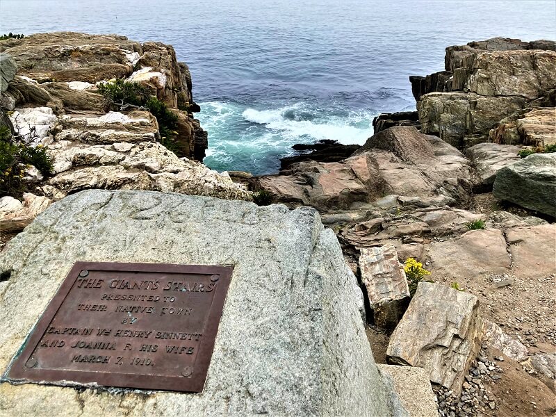
Giant’s Stairs trail is a short route that begins from Bailey Island near Harpwell. Watch out for the trailhead marker. The trail runs hugging the coast and provides beautiful views of Casco Bay, and further on a clear day.
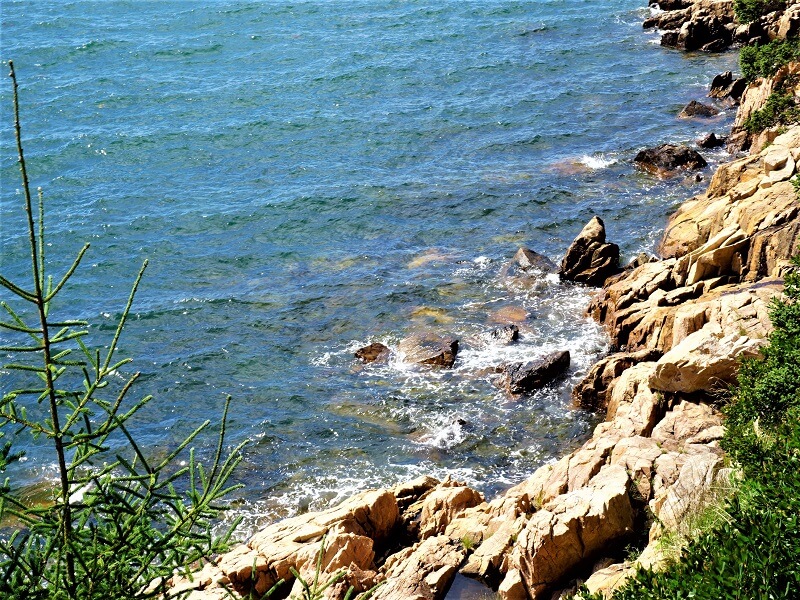
The coastal walk meanders around large uneven rocks and loops back to the entry point. Gradual erosion has created interesting shapes – the huge giant-sized stairs – which Geologists have named ‘Intrusive volcanic dike’.
It is a quiet, almost desolate, spot where you can just watch the waves hitting the rocks throwing up sea spray.
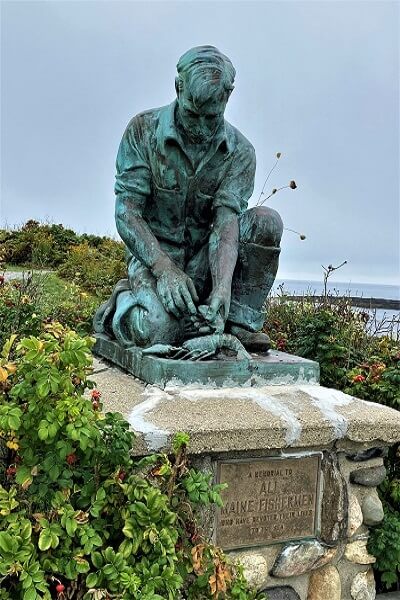
We drove further towards the Land’s end where there was a huge bronze statue of a ‘Maine’s fisherman/ lobsterman’. Caution, there are signs to stay away from Poison Ivy plants here and there. A peaceful place to watch the boats go by and admire the rugged coastline.
Rockland Breakwater Lighthouse
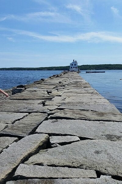
An hour and half from Giant stairs is this unusual experience with a lighthouse! Walk out to sea without getting your feet wet!
The lighthouse is located at the end of an almost mile-long breakwater path. On a clear day when you can see the path and when it is not submerged in water, visitors can walk to this lighthouse and also climb to the top to get great views.
It was windy and visibility was not good when we landed there, and we were unsure whether we should do it. What if the path got submerged on our way out! Anyway, we did start the walk. The path had uneven large stones with big gaps between them, was slippery and we had to walk carefully.
About half through the walk, we decided to turn back. Took some pictures and enjoyed views.
DAY TWO
Acadia National Park
National Park? Well…..To us it seemed to be more of a tourist resort than a national park. It was chock-a-block with people and cars when we went there, and it was not even high season! Nevertheless, we found things to do in this park.
Drive the 27-mile Park Loop Road and enjoy the views of the rugged Acadia coastline.
The loop road is the best way to do a quick tour of Acadia. – Drive to Thunder hole or Otter cliff or anywhere you can park (not easy!) and hike along the ocean path to explore granite rock formations. There are several hiking choices for hiking enthusiasts.
GPS is definitely spotty here, so picking up a map is useful.
The visitor center is full of cars! A number of visitors prefer to leave their cars here and take shuttle buses to various destinations within the National park. Of course, there is an entry fee and a ticket to drive your own car in the national park.
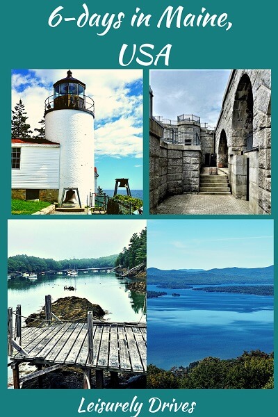
The Bass Harbor Head Lighthouse
It is a landmark and a must-see.
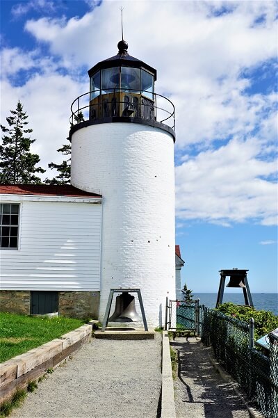
The Bass Harbor Head lighthouse, constructed way back in 1876, is the most photographed and visited lighthouse in Maine.
Located at the southernmost tip of the Mount Desert island south of the popular Bar Harbor, it is fenced off and involves a short walk from the parking lot. You can stand right next to the bell and the lighthouse.
There is another trail into the woods and along a boardwalk and stairway leading to some rocks from where you can get a different perspective of the lighthouse.
Due to the high popularity and depending on the season, there are huge queues here.
Bar Harbor
It is a tourist town you can visit on your way back from the national park. It is very busy with shoppers and visitors and it is probably best to just drive through the town to get an idea of what is there to see and do.
Jordan Pond nature trail
This is a great trail for families. The Jordan Pond House and restaurant are popular and located on a hill overlooking the pond.
Prospect Harbor and Gouldsboro Pier
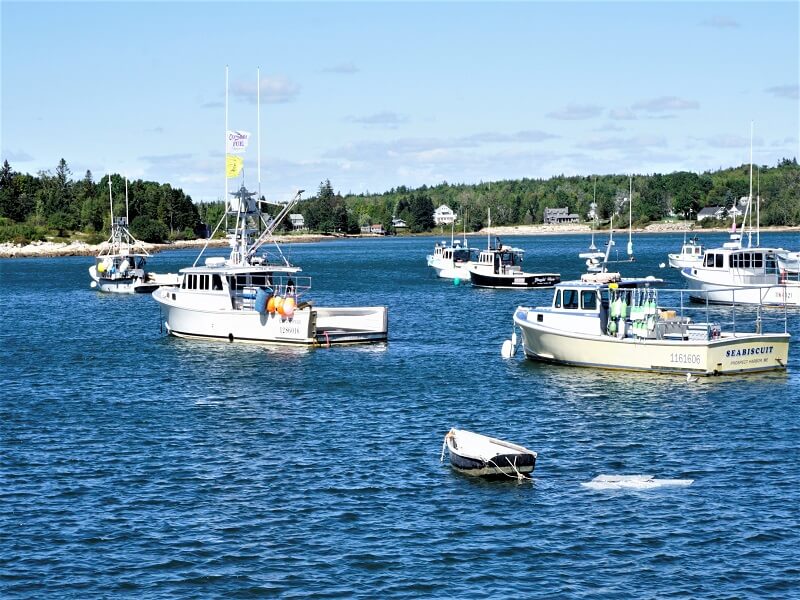
Located in another part of the peninsula are the less popular Prospect Harbour and Gouldsboro Pier. It is totally peaceful with literally very few visitors and offers the same kinds of views as the Acadia National park.
DAY THREE
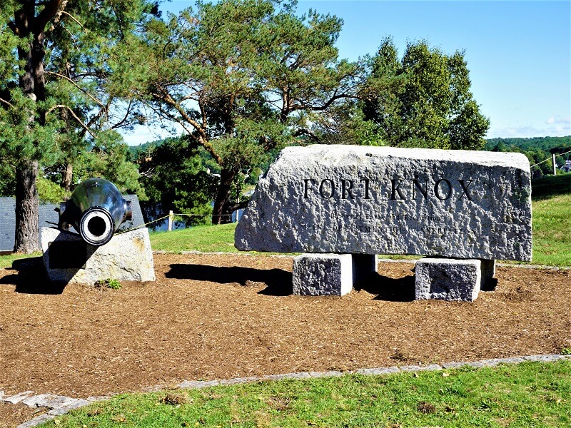
Fort Knox and Penobscot Narrows Observatory
This visit has historical and engineering marvels to learn about and admire.
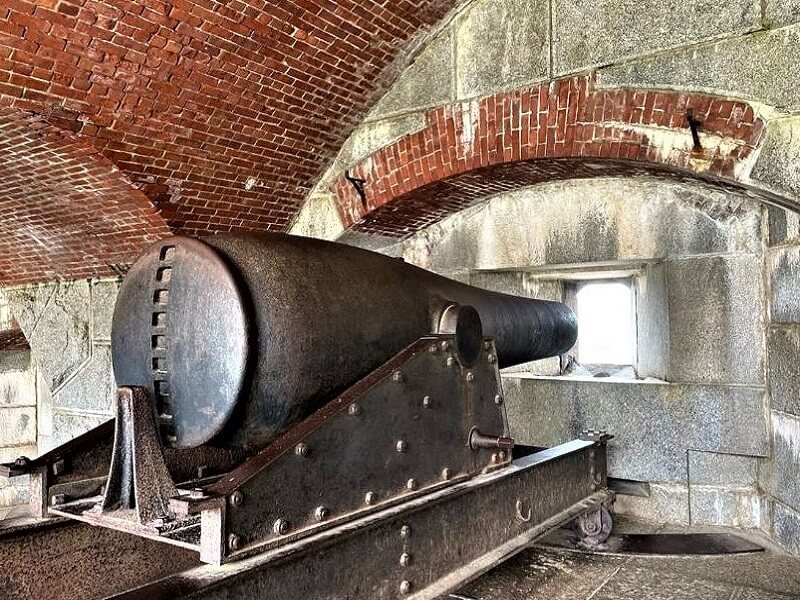
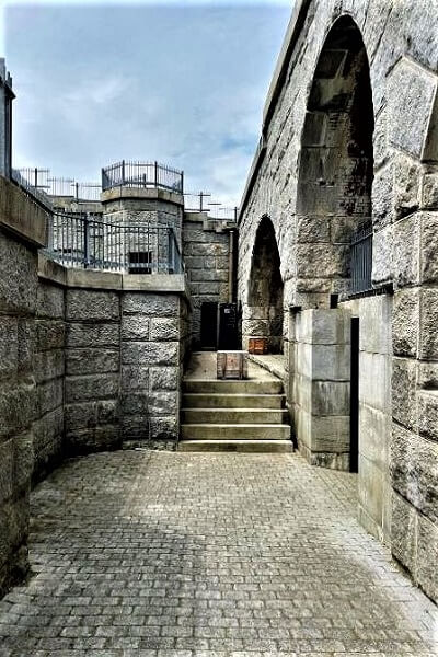
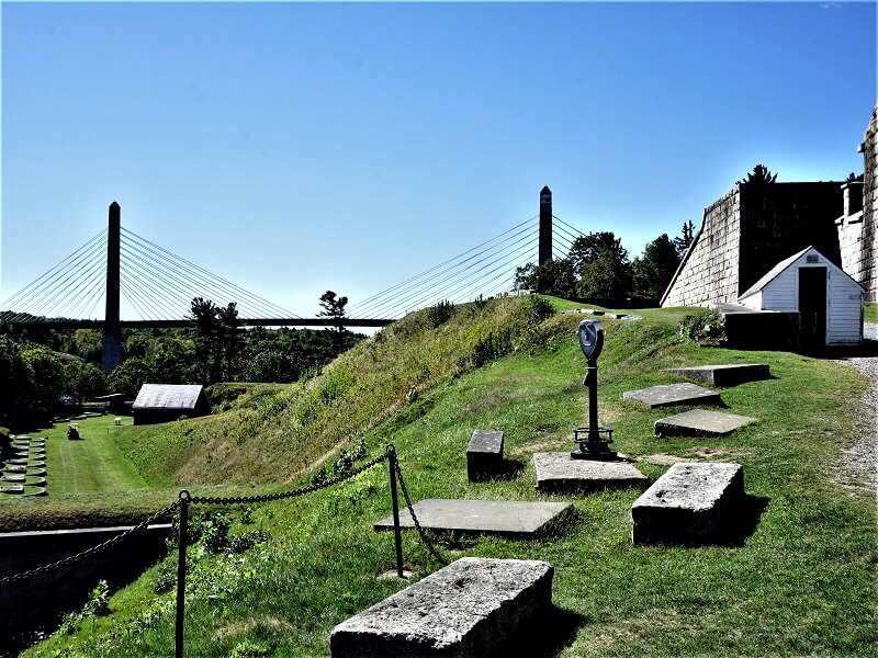
The historic site of Fort Knox is one of the well-maintained coastal defense structures from the mid-1800s. It was built during the civil war to defend Maine but never saw action. We spent a few hours looking around and exploring the entire structure and grounds, plus the one-room museum about the fort’s history located right on the water edge. There are good views of the town of Buckport and the huge Narrows bridge from the fort’s parapets.
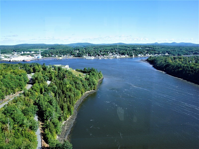
Penobscot Narrows Bridge and Observatory look impressive. We took the elevator up 420 feet for sweeping views of 360 degrees from the top of the Bridge observatory – that included the Penobscot bay, mountains and forests around 100 miles.
This is a must-visit for history buffs, engineers and photographers too.
Bangor
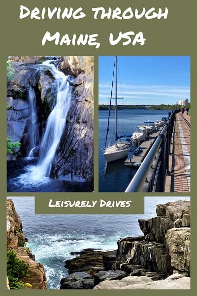
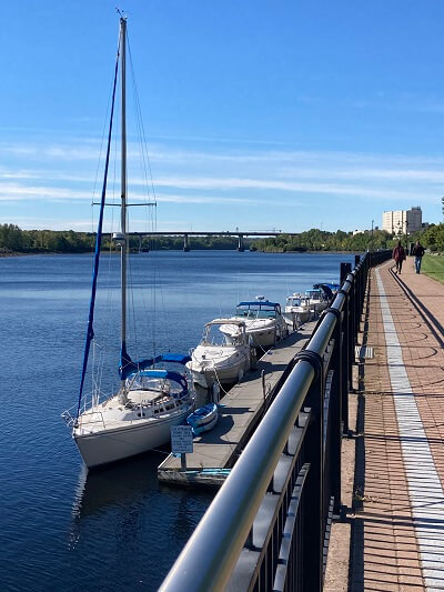
We drove up to the famous Bangor waterfront and enjoyed the views of the deep blue Penobscot River, boats and bridges. It is also a place that has cruise ships and a heavy vessel dock facility.
The waterfront offers walking trails, picnic tables and benches and a good parking lot too. Bangor is a good place to stop by if you are passing through.
DAY FOUR
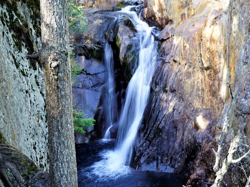
Smalls Falls
Located on the route 4 going north from Farmington, watch out for the sign as it is not very big. The sign says ‘Smalls Falls Resting Area’. Drive into the turn off as far back as you can where you take the steps down to the bridge across Sandy River.
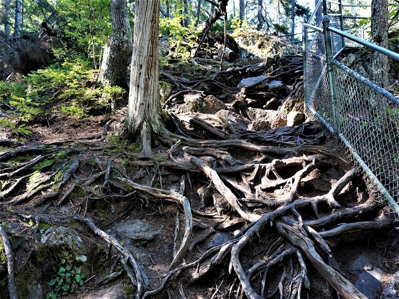
Walk up on uneven ground with huge tree roots (watch your step) to the other side of the river where you will be able get views of the falls. There are four falls – first one is easy, then you need to continue walking without support over rocks.
Smalls falls is totally worth a stop. There is a gorge where the falls drop.
We came across a bunch of adventurous young boys diving into the gorge from the rocks above!
Daggett Rock
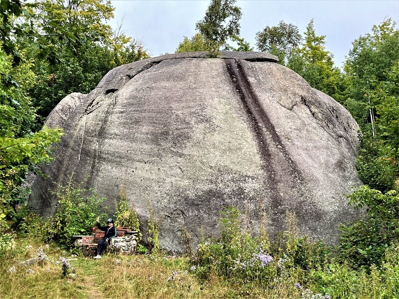
Maine’s largest Glacial Erratic is located off the Wheeler road in Philips from the main route 4.
Drive slowly along the road watching out for the sign – which, as usual, is hidden behind leaves and not prominent. There is parking for about 4 cars.
A glacial erratic is a piece of rock (of various sizes) which had been carried away by glacial ice to a place far away. When the ice melted the rock stayed in the new location. Daggett Rock, which is about 80 feet long, 30 feet wide and 25 wide and weighing some 8,000 tons is considered to be the largest glacially transported erratic in Maine.
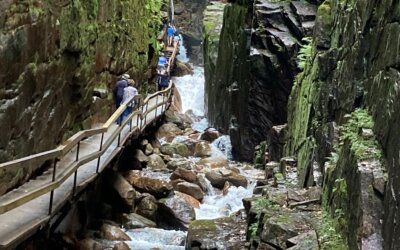
We saw similar erratics called Glacial Boulders in the Flume gorge in New Hampshire.
Once you have found the signpost and parked, walk along a dirt path that leads to the rock. It is a good half hour to 45 mins walk on a moderately steep path. When you finally see the rock, it is fascinating and giant sized. The rock is split into two on the side. You can walk around it and take pictures.
DAY FIVE
Height of Land
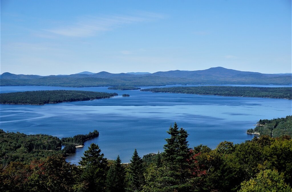
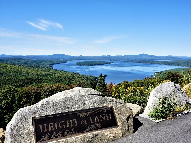
One of the top attractions that is worth stopping along the Rangeley Lakes Scenic Byway is the ‘Height of Land’. This spot some provides magnificent panoramic views and stunning overlooks. The spectacular views of the blue Mooselookmeguntic and Richardson lakes, and also the White Mountains in the background make it the perfect setting for photographers, tourists and artists.
We walked around, took in the views and took some photographs. There are some educational signposts with a lot of information on hikes, and adequate parking.
Coos Canyon and Gorge
Located on the route 17 in Byron a bit further to Height of Land on our way back.
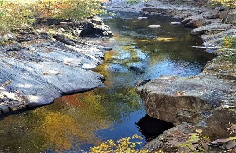
We parked on a dirt track and walked to the canyon. This place is not very well maintained and lacking signage. The gorge and the cascade waterfall can be viewed best from the bridge.
There are tables outside a restaurant cum store across the road – where we had some hot chocolate.
DAY SIX
Rangeley Lakes Scenic Area
The Rangeley Lakes area is a 52-mile stretch of road with gorgeous scenery and stops along the way. Route 17 is the best way to take rather than the route 4 which we found passes through some rough terrain that needs a four-wheel drive.
Beyond the Height of Land, the road takes you all the way with Mooselookmeguntic lake on the left and Rangeley lake on your right. If you are an adventurous hiker, this place provides a number of hikes– easy and challenging, including the legendary Appalachian trail. In spite of the weather being cold, the sun can be quite strong here.
We had a good meal at Portage Tap House. Good parking lot, excellent service and a great choice of food.
Overall, we had a great 6 days but thought there was a significant lack of good signage in Maine for visitors. In most of the places including in route 17 and 4, there is little or no mobile connectivity making the tourists unaware of where they are and how far the destination is. Yes, a good old-fashioned map might be the solution.
On day seven, we drove out of Maine to the granite state of New Hampshire for the next part of our 3-week New England tour.
Related Posts
Driving the Blue Ridge Parkway – North Carolina
Why build a 469-mile long road on top of a mountain? Not for transport, really. Commercial vehicles are not allowed, the road is often closed in winter, and speed limits are quite low. Well, never mind…we are glad that it was built, because it is a beautiful,...
A Fun Trip to Grandfather Mountain – North Carolina
Blue Ridge Parkway and Grandfather Mountain - folks in North Carolina sure know how to pick interesting names! During our 10-day road trip in North Carolina, we passed through the scenic ‘high country’ and stayed at the quaint mountain town of Banner Elk for a couple...
Easy Hike to High Falls Gorge – New York
Waterfalls can be challenging. By their very nature waterfalls embody a change in elevation, which means that to reach a waterfall you often have to climb a lot, either on the way to or the way from. Tough for many people. How about enjoying spectacular views at not...
A Fun Hike to Flume Gorge – New Hampshire
A fun hike amidst geological marvels – a must-see when you visit New Hampshire. The hike will take you through dramatic volcanic and glacial wonders in the White Mountains of New Hampshire with interesting stops and unusual views. It can be a little difficult in...
A Road Trip through New Hampshire – USA
New Hampshire has something for everyone - with its bountiful scenic spots, waterfalls, covered bridges, quaint towns, wilderness and loads of trails. This Granite state is home to the Appalachian Trail, White Mountains and Mount Washington as also many deer, bear and...
Enjoying Canadian Rockies
Planning a visit to the Canadian Rockies? Amazing scenery awaits you. The Rockies destinations of Jasper, Banff, Lake Louise and Columbia Icefields Parkway offer unforgettable experiences. Here goes.ATHABASCA FALLS With a drop of 80 ft and a width of 60 ft, Jasper...
Vancouver in 2 days – Canada
We landed in Vancouver after 3 weeks of pleasurable adventure exploring Canada by rail and coaches. Two days seemed less but were just right to fit in the best of the beautiful city of Vancouver, and Victoria in Vancouver Island. Here’s what we did. Day 1 in...


The East coast in the Fall has been on my bucket list forever. Hopefully in 2023.
Enjoyed your photos and descriptions of these beautiful sites of your trip! It’s so helpful to learn about it. Thank you!
Wow, that Cribstone Bridge sends vibes thar range from scary to impressive. I would never think it would last for almost a century!
Maine is so lovely! I’ve been looking for New England travel trip ideas for this summer! Glad I found this!
We did a great road trip to Maine but I must admit that we stayed along the shore. Good to know there are some great reasons to head inland too. We need to go back and spend more time exploring Acadia National Park. You found lots of great stops on your trip.
Beautiful! I would love to road trip around Maine. I would especially love to see Smalls Falls. Great post!
What a lovely road trip. I look forward to driving it one day.
I’ve driven through Maine close to the Canadian border, but have always wanted to return. Your article shows me why. This great 6 day road trip is perfect, with some great stops of the Acadia National Park, the lighthouse and just being able to see that beautiful coastline.
Thanks for this ready plan to Maine, as it’s on my bucket list! I love the seaside and lighthouses, so I’m happy to check all your recommendations. I would like to see Rockland Breakwater Lighthouse, Bass Harbor Head Lighthouse the most, and Penobscot Narrows Observatory.
Such a pretty drive! I love all the dramatic rocks, especially the huge erratic and the Giant’s Stairs. Also, Mooselookmeguntic might be my favourite lake name 🙂
Before I even visited the US for the first time, I always wanted to go to New England. Actually, I was interested in the heritage, but from your pictures, I can see that it’s definitely a must to visit the countryside. It looks just beautiful, and I would like to visit during the Indian Summer, obviously.
Wish you got to drive to Schoodich, the other part of Acadia. It’s so beautiful out there. We stopped at Fort Knox and Penobscot Narrow Observatory, too. We didn’t hear about the place until we drove by it. For me it’s a pleasant surprise. Next time we go to Maine, I want to visit the Giant’s Stair Trail and McIntosh Lot Preserve and Height of Land. They look amazing.
I can’t read “Bar Harbor” without hearing “Ba Haba” — ha! As a kid, we traveled to Maine many summers, and it’s so beautiful. I’m sad I’ve never been to Acadia National Park, though. It looks so lovely. I also really like that you explored over 6 days. I feel like many people try to cover as much ground as possible (going from state to state) in a short amount of time, but I like the idea of sticking with one state. Sounds like a fun trip!
I would love to do a road trip like this in the US. As I have read so many amazing things about the Acadia National Park, I would make sure to spend a few days there. And I love lighthouses, so this would be an additional draw for a road trip through Maine. I bet they have amazing seafood as well.
I really like how you’ve planned your trip taking those diversions from the main route to accommodate the Acadia National Park, Height of Land etc. Cribstone bridge sounds super interesting and my daughter’s gonna love anything to do with volcanoes. Too bad Acadia National Park felt more like a touristy resort! As someone who loved old forts & castles, I wouldn’t miss Fort Knox!
I love the opening picture with blue skies and blue waters. I would like to see the Rockland lighthouse. Even though, the walk is difficult, it seems like an adventure. I would also like to see the canyon and the gorge. It would actually be fun to do this entire belt.
Thank you for sharing about your trip. I did not realize that there is so much to see and do in the area. We’d love to visit the historic site of Fort Knox. The view from the Height of Land is also beautiful.
This is undoubtedly a memorable route to follow. So many diverse and beautiful sites. Would like to visit Coos Canyon and Gorge and Fort Knox, and Penobscot Narrows Observatory.
Beautiful picture. A road trip through the north east has been on my bucket list for forever. One of these summers I’ll go.
What a great blog, so much history and nature is at its best. Fantastic photos.
What a great itinerary for Maine. Those photos are stunning!!!